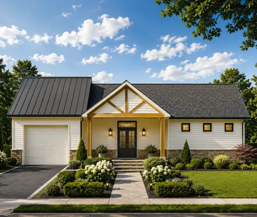
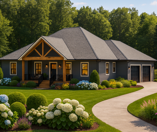
The listing said 1.2 acres with a creek out back. Then the wetland flags went in, the county buffer was drawn around them, and the buildable part of the lot turned out to be a strip about 70 feet deep. This happens often, and it can happen to you. Water on or next to a lot is one of the best things a home site can have. It is also the thing most likely to change what you can build, where you can put it, and how long the permit takes.
Use this checklist in order. Each stage builds on the one before it. The goal is to know your real building envelope before you fall in love with a floor plan.
Stage 1: Find the water before you sign
- Wetland maps: check the National Wetlands Inventory mapper from the U.S. Fish and Wildlife Service and your county GIS viewer. These maps are screening tools, not legal boundaries, but a mapped wetland on or near the lot is a red flag worth paying attention to.
- Flood zone: look up the parcel on FEMA's Flood Map Service Center. An A or AE zone usually means a required elevation and flood insurance. A VE zone on the coast usually means pilings or columns and an open lower level.
- Soils: the NRCS Web Soil Survey shows hydric (wet) soils and drainage classes. Poorly drained soils can also rule out a basement or a conventional septic field.
- Site clues: walk the lot in early spring or after heavy rain. Look for standing water, cattails, sedges, water-stained leaves and spongy ground.
- Disclosures and plats: ask the seller for any past delineation, recorded conservation easement, or HOA restriction on the shoreline. Read the recorded plat for "wetland," "buffer" or "no-disturb" notes.
- Contingency: write a due-diligence or feasibility contingency into the purchase contract so you can walk away if the buildable area comes back too small.
Advice: if any of these checks turns up water, budget for professional work before closing, not after. A few thousand dollars spent during due diligence is cheap compared with owning a lot that only fits a 900-square-foot footprint when you planned on 2,500.
Stage 2: Draw the real lines on the lot
- Wetland delineation: hire a wetland scientist to flag the boundary in the field using the Corps' delineation manual and its regional supplement. In 2025 a residential lot delineation typically ran from about $1,500 to $5,000, more for large or complicated sites.
- Survey: have a licensed surveyor locate the flags and the ordinary high-water mark of any stream or lake, and put them on the site plan together with your property lines and setbacks.
- Jurisdictional determination: ask whether you need one from the Army Corps of Engineers district office. After the Supreme Court's 2023 Sackett v. EPA decision, fewer isolated wetlands fall under federal jurisdiction, but state and local rules can still protect them fully.
- Local buffer: get the buffer width from the city or county code. Buffers of 25 to 100 feet are common, and high-value wetlands or trout streams can carry wider ones. Some codes add a further building setback of 10 to 15 feet beyond the buffer.
- State rules: many states have their own wetland, shoreland or critical-area programs. Examples include shoreland zoning around lakes in the Upper Midwest, Maryland's Chesapeake Bay Critical Area, and critical-areas ordinances in Washington State. Ask the local planning office which programs apply to your parcel.
- Other setbacks: mark the septic setback from water (often 50 to 100 feet, set by the state or county health department), the well setback, and the normal front, side and rear zoning setbacks.
Advice: put every line on one drawing, then shade what is left. That shaded shape is your building envelope. Measure its depth and width. Do not rely on its acreage. The house, the garage, the driveway, the septic field and a construction work zone all have to fit inside it.
Stage 3: Sort out which permits you need
- Section 404: a permit from the U.S. Army Corps of Engineers is needed if you will place fill or dredged material in waters or wetlands under federal jurisdiction. Fill includes a driveway crossing, a foundation pad, or grading. Small residential fills are often handled under a nationwide general permit, sometimes with a pre-construction notification. Larger impacts need an individual permit, which can take many months.
- State water quality certification: a federal permit usually needs a Section 401 certification from the state. Some states also issue their own wetland or stream permits.
- Local approval: this may be a shoreline permit, a critical-area review, a buffer variance or a conditional use permit. Variances usually need a hearing and proof of hardship, so do not count on one.
- Stream crossings: a culvert or bridge for the driveway often needs its own approval and engineering.
- Stormwater and erosion control: expect a grading plan, silt fence, and possibly rain gardens or other runoff treatment near the water.
- Mitigation: if fill is approved, you may have to restore or replant buffer area, or buy credits from a mitigation bank. Ask for a cost range early.
Advice: the cheapest permit is usually the one you design out of. Moving the house 20 feet or turning the garage often keeps everything outside the wetland and buffer. Then you need only the building permit and an erosion plan. Hold a pre-application meeting with the planning department before you finalize a plan. It is usually free or low-cost.
Stage 4: Pick a plan that fits what's left
- Footprint first: compare the plan's overall width and depth, porches and garage included, with your envelope. Total square footage does not matter at this step.
- Build up, not out: a taller house delivers the same living space on a smaller footprint. A plan like this compact 3-story farmhouse with 4 bedrooms in 1707 sq ft stacks rooms vertically and needs far less ground than a sprawling one-story. Browse more 3-story house plans for the same approach.
- Shape: a shallow envelope along a buffer line favors wide, shallow plans. A deep, skinny strip calls for narrow lot house plans.
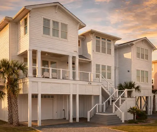
- Flood elevation: in coastal and riverine flood zones, a raised plan solves both the elevation rule and the footprint problem. The 3-story coastal plan with 4 bedrooms and 2120 sq ft and the 4-level beach house with 4 bedrooms in 2696 sq ft keep living spaces high, with parking below.
- Foundation: high groundwater often rules out a basement. Plan for a crawlspace, a raised slab or piers, and confirm with a local engineer.
- Garage and driveway: a 3-car garage can eat 700+ square feet of envelope. A plan with a tuck-under or 2-car garage frees ground for the septic field.
- Views: put the living room, kitchen and main deck on the water side. Check whether decks and patios count against the buffer in your jurisdiction. In many codes they do.
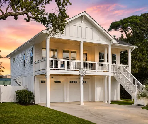
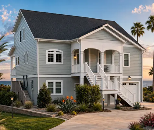
Advice: start with the envelope and then search for plans. Doing it the other way around wastes time. If your lot fits a vertical farmhouse better than a wide ranch, compare something like the 3-story Modern Farmhouse with 4 bedrooms and 2649 sq ft or the 3-story country farmhouse with 3 bedrooms in 2964 sq ft with a broad one-story Modern Farmhouse of 2742 sq ft. The living space is similar, but the ground each one covers is very different. Whichever plan you choose, have a local engineer or drafter adapt it to your site, your foundation and your local code amendments.

The most common mistakes
- Trusting the acreage instead of measuring the buildable envelope.
- Treating online wetland maps as final. Only a field delineation sets the line.
- Clearing or grading before permits. Even mowing or filling a wet corner can trigger violations and restoration orders.
- Forgetting the septic field and its setbacks when placing the house.
- Counting on a variance to make an oversized plan fit.
- Ignoring the construction zone. Crews, equipment and stockpiles need room outside the buffer too.
Rules differ by state, county and even by watershed, and they change. Confirm current buffer widths and permit requirements with your local planning office, the Corps district, and a qualified architect or engineer before you buy or build.